Motorcycle Trip Newport, OR to Goldendale, WA 2020-05-15
 A playlist of all of the videos from the ride from May 13 thru May 16.
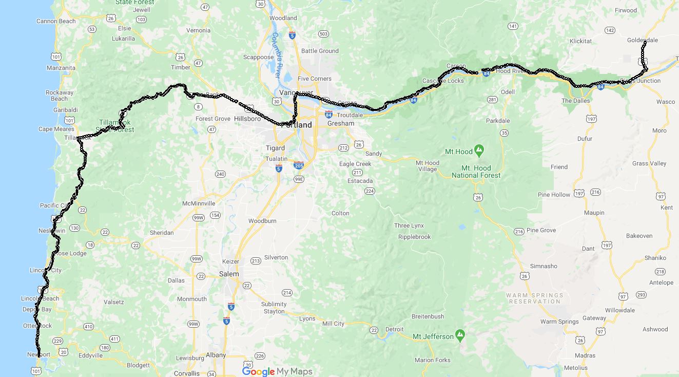
We started our ride From Newport Oregon to Goldendale, WA and mapped it so that we would go along the Columbia River on the Washington State side. Lewis and Clark Hwy Rt 14. It was mapped out from Newport to Goldendale, OR. First task was to find coffee and breakfast. The Coffee House in Newport provided coffee and breakfast sandwiches.
We went north on Highway 101. This day was sunny, hardly any coulds in the sky Beautiful. We rode along the highway with the ocean to the left and sunshine, click for video of this ride.
We rode along East Devil's Lake and up Highway 101, click here for video both of which had good twisties. A little later we turned on to Route 6 which ALSO had great twisties. About 9 minutes out from Tillamook we were in some GOOD twisties but I had a reminder of road riding ... Never hit apexes unless you KNOW there is no traffic. At about 4:28 in this video the truck driver decides to take ALL of their lane and part of mine. Notice that I had already started to move back towards the edge and continued moving away.
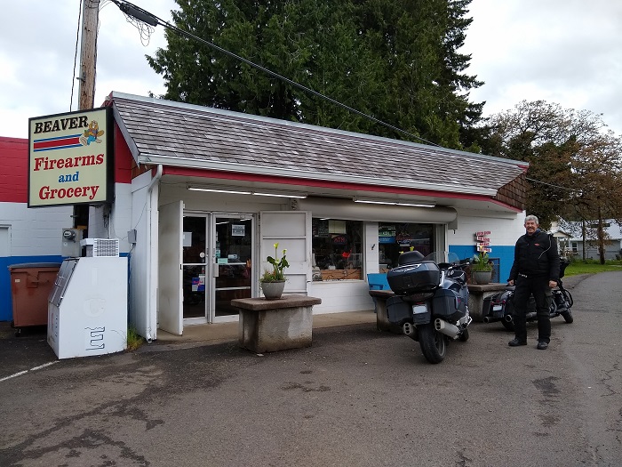
Along Highway 101 in Beaver Oregon we found the perfect store. Firearms and Groceries. You go out hunting in the morning, grab your supplies and if you don't get any game you come back and get dinner:

We continued East through Portland to Route 14, as we crossed back into Washington State, Cody pointed to the sign, click here for video He may have been happy to be back in his own state.
The Bonneville HydroElectric Dam is one of the larger electrical producing dams for the state. And is a sight to see :-):

We continued swapped bikes at Bonneville so I could try his Street Glide and he could try out the BMW K1600. We rode from Bonneville Dam to the Hood River Toll Bridge, this is a video of most of the ride, a nice sunny day. We swapped bikes back at the Dog Mountain Trailhead about half way through the video so you can see and hear the bike differences.
The Columbia river is wide and peaceful, here is a shot at the Dog Mountain Trailhead:

Motorcycle Trip To The Olympic Peninsula
Any questions or comments send me e-mail
Username = "GandalfDDI"
E-Mail = "Outlook.Com"
Obviously to send me e-mail just put the preceding two together --> Username@E-Mail (this is to minimize the amount of SPAM I get thank you)
Elevations for this ride so you can predict how cold you may get. Y Axis is altitude feet, X Axis is Miles travelled:

 A playlist of all of the videos from the ride from May 13 thru May 16.


